
![]()
Aerial photos described here come from Pictometry International Corporation. Pictometry specializes in oblique aerial photography taken from low-flying airplanes.
Oblique aerial photos show buildings, infrastructure, and land from all sides. As a result, you see more natural three-dimensional perspective views of buildings and other features on the ground than you see on orthophotos.
Pictometry provides a total of five views of each photographed area. In order to see all sides of buildings and other features, four oblique photos are taken looking to the north, south, east and west. Pictometry also includes orthophoto views looking straight down. As compared to these "straight down" views alone, Pictometry's oblique photos can dramatically improve your understanding of what's on the ground.
Pictometry International Corporation can "fly" two categories of photos that have different levels of detail:
All Pictometry oblique photos are taken at an elevation angle of approximately 40 to 45 degrees.
Maximize your browser window or scroll to the right to see these examples:
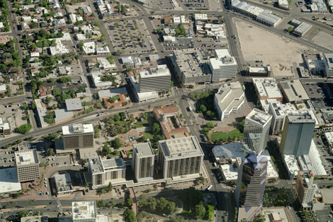
| Oblique photo as seen in the Pictometry Viewer Shows the full extents of the photo with the typical perspective view. Things are smaller further away. |
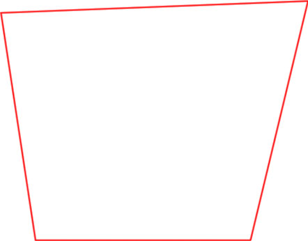
Outline of the photo's area on the ground Covers more area further away |
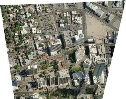
Oblique photo stretched to the ground area on a map The scale is consistent across the map. (This image was made with the Pictometry for ArcGIS Desktop extension.) |
 |
 |
 |
The photo airplane crisscrosses back and forth over the project area taking pictures at frequent periodic intervals. Each timed camera "shot" takes five photos at once (N, S, E, W, and an orthogonal photo which is converted to an orthophoto later). The distance between flight lines and the photo interval along the flight lines is relatively small, causing each ground location to be photographed several times. There could be a few to as many as six or more photos taken of each point on the ground in each direction. Therefore, nearby photos overlap considerably. When looking at an area with the Pictometry Viewer, the viewer chooses what it considers the "best" photo of that area for each photo direction and the orthophoto (straight down) photo from the available photos. "Best" in this case means:
While the Pictometry Viewer chooses what it thinks is the best photo of an area, you can see the other photos that include the red crosshair location by using the Next Image and Previous Image tool buttons.
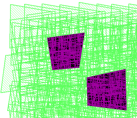
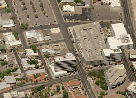
The first map clip below shows the outlines (the green border lines) of all oblique photos looking in all directions (N, S, E, W) near a corner of the project area. The displayed area is about 1.5 miles wide. The two darkened areas show the coverage of two individual oblique photos, one looking North and one looking East.
The second map clip below serves no purpose other than being an interesting design made with MapGuide. (MapGuide is no longer available and our newer PimaMaps system works differently.) The image was made by selecting a small rectangular area with MapGuide's Select tool, selecting all photo areas that contained or touch the defined area. MapGuide indicated selections by inverting their color (white to black and green to purple in this case). Selecting by area selected all map features under the selection area - the "stack" of photo areas. Each selected photo area under the first selected photo area inverted the displayed color again. With many overlapping photos and intersections of photo areas the result is that areas with an odd number of selected overlaps have their colors changed, and areas with an even number of selected overlaps have no apparent color change. The result is a interesting design with no practical use except to illustrate that there are a lot of overlapping oblique photos!
| 1. Superimposed oblique photo areas with two photos highlighted |
2. Interesting design of MapGuide selection artifacts |
 |
 |
While most Pictometry photos are used for reference, some can stand alone as works of art in their own right. See Selected Pictometry Photos for a few spectacular Pima County examples.
Sometimes we get asked "Where are the people?" Pictometry has good enough resolution that people can be seen. They aren't masked out of the pictures. People are relatively small as compared to buildings and other photo features so you may not see people at first. Then too, it may be that not too many people are out in the sun mid-day on a May day in Tucson.
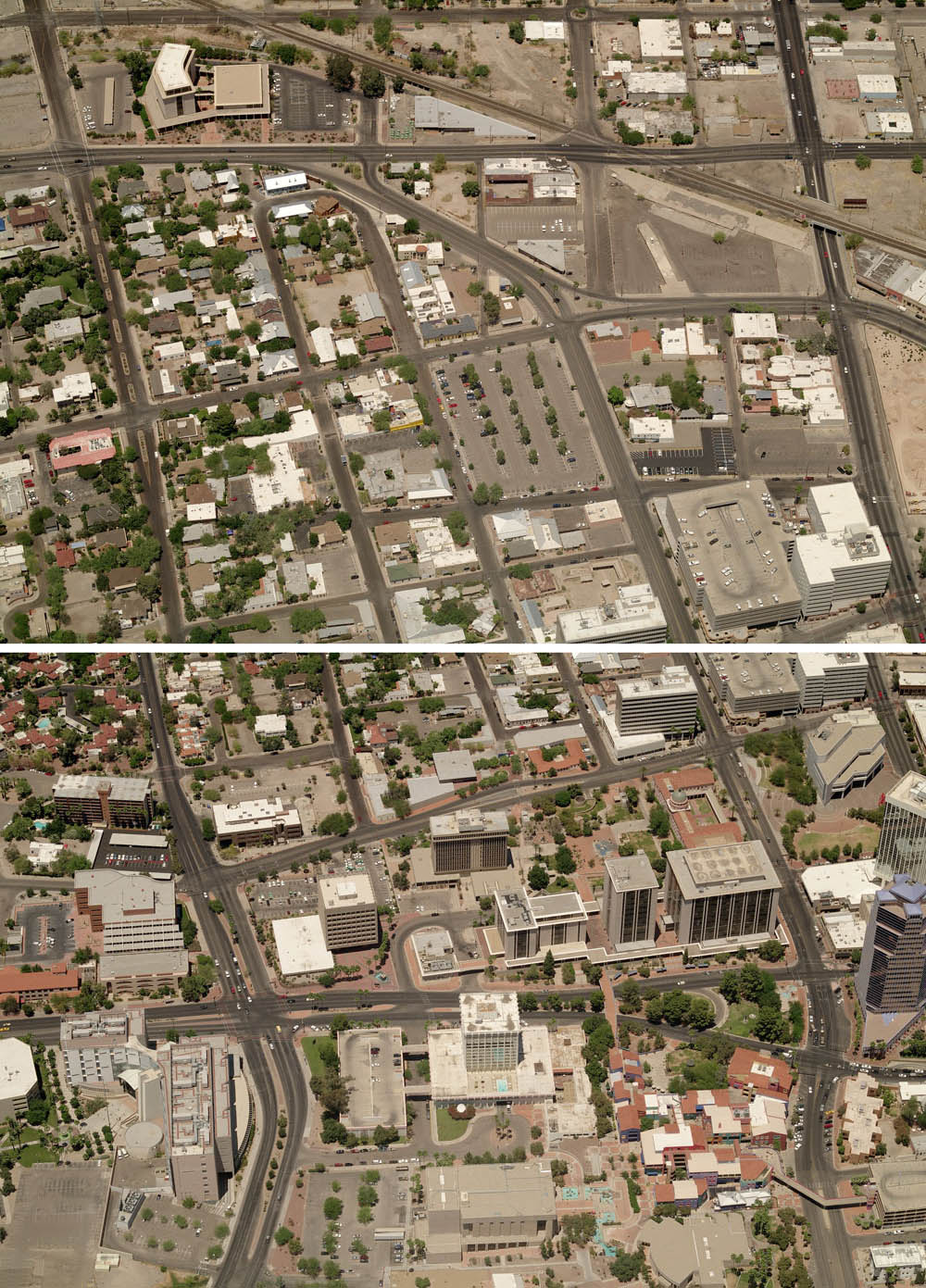
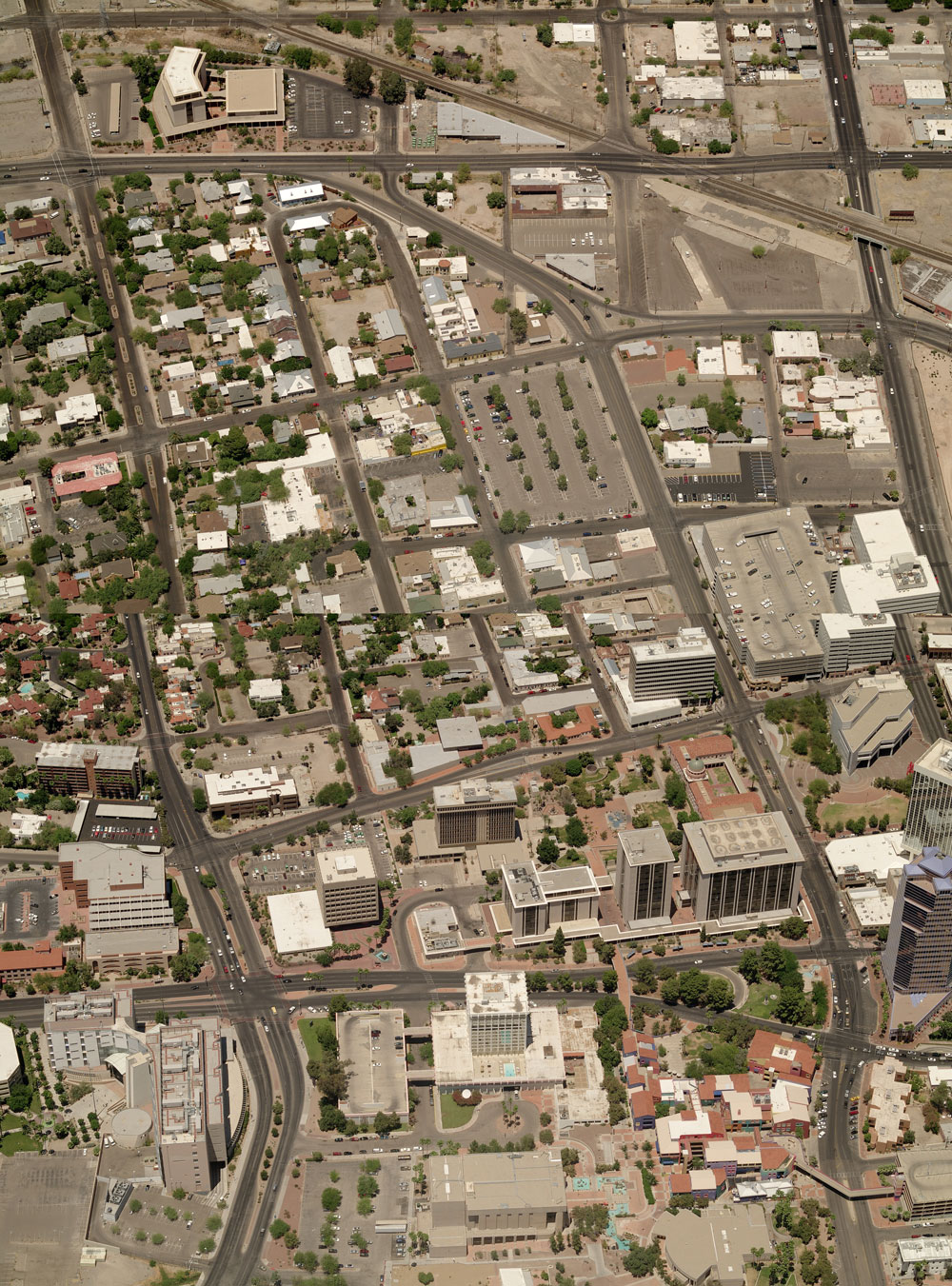
Due to the perspective nature of Pictometry oblique photos, it's not possible to seamlessly join individual photos to make an image of a larger area. This is because the scale and size varies from near to far across each photo. For example, see two adjacent photos and what happens attempting to merge and align them on a large parking garage near the right edge. You can easily see that the building sizes are different and that the streets don't line up.
(There is one exception for joining Pictometry oblique photos. Using Esri's ArcMap software with the Pictometry for ArcGIS Desktop extension and access to the photo library, individual oblique Pictometry photos can imported into the ArcMap Data view. Each individual photo is stretched to a consistent scale across the photo, making it possible to see multiple photos aligned on the map. While this "flattens" out the perspective view, the oblique nature of the photos is retained.)
| Portion of attempt to merge and align oblique photos The west edge of the parking garage is nearly aligned but everything else is way off. |
 |
All Pima County Pictometry project years include higher resolution "Neighborhood" photos. Starting in 2016, projects also include lower resolution "Community" photos in selected outlying areas.
| Project Year | Project Area | Photo Dates | ||||
|---|---|---|---|---|---|---|
| 2022 | Metropolitan eastern Pima County plus Ajo area |
|
||||
| 2020-FIRE | Bighorn Fire area |
|
||||
| 2020 | Metropolitan eastern Pima County plus Ajo area |
|
||||
| 2018 | Metropolitan eastern Pima County plus Ajo area |
|
||||
| 2016 | Metropolitan eastern Pima County plus Ajo area |
|
||||
| 2014 | Metropolitan eastern Pima County plus Ajo area |
5/10/2014 through 5/24/2014 | ||||
| 2012 | Metropolitan eastern Pima County plus Ajo area |
4/28/2012 through 5/27/2012 | ||||
| 2010 | Metropolitan eastern Pima County plus Ajo area |
4/28/2010 through 6/13/2010 | ||||
| 2008 | Metropolitan eastern Pima County plus Ajo area |
5/10/2008 through 5/19/2008.
In addition, 242 of 142,070 total oblique photos were taken on 6/4/2008 and 6/5/2008. |
||||
| 2006 | Metropolitan eastern Pima County | 5/16/2006 through 6/20/2006 |
![]()