 .
Please include note a telling us what your were doing when the error occurred as well as any other helpful information you can include.
.
Please include note a telling us what your were doing when the error occurred as well as any other helpful information you can include.
There was an error processing your request.
To report this error, please copy the contents of this page and paste it into
an email to
.
Please include note a telling us what your were doing when the error occurred as well as any other helpful information you can include.
Error
Could not find the included template /mapguide/mgtips/captureandprint.inc. Note: If you wish to use an absolute template path (for example, template="/mypath/index.cfm") with CFINCLUDE, you must create a mapping for the path using the ColdFusion Administrator. Or, you can use per-application settings to specify mappings specific to this application by specifying a mappings struct to THIS.mappings in Application.cfc.
Using relative paths (for example, template="index.cfm" or template="../index.cfm") does not require the creation of any special mappings. It is therefore recommended that you use relative paths with CFINCLUDE whenever possible.
The error occurred on line 63.
Error Path
/pictometry/latlon/help/printing.cfm
Query String
(none)
HTTP Referer
http://gis.pima.gov/pictometry/latlon/help/printing.cfm
Browser
Mozilla/5.0 AppleWebKit/537.36 (KHTML, like Gecko; compatible; ClaudeBot/1.0; +claudebot@anthropic.com)
Generated Content

![]()
Unfortunately, the Legacy Pictometry Viewer has no built-in printing capability and there's no way we can add it. Options for printing in order of preference include:
The image quality of your print depends in part on how much of the photo area you use. That is, how big the pixel area is that you select from the photo. You may want to try all four photo directions as the area you print will likely appear as somewhat different sizes in the four views. That is, the four pictures are taken a somewhat different distances from any particular area and the one with the closest view will have the most pixels of the property.
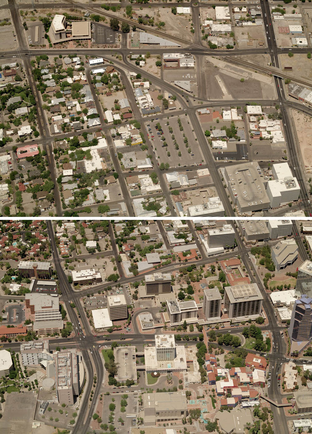
Due to the perspective nature of Pictometry oblique photos, it's not possible to seamlessly join individual photos to make an image of a larger area. This is because the scale and size varies from near to far across each photo. For example, see two adjacent photos and what happens attempting to merge and align them on a large parking garage near the right edge. You can easily see that the building sizes are different and that the streets don't line up.
(There is one exception for joining Pictometry oblique photos. Using Esri's ArcMap software with the Pictometry for ArcGIS Desktop extension and access to the photo library, individual oblique Pictometry photos can imported into the ArcMap Data view. Each individual photo is stretched to a consistent scale across the photo, making it possible to see multiple photos aligned on the map. While this "flattens" out the perspective view, the oblique nature of the photos is retained.)
 Download Photo as JPG button.
Capturing the photo image from the screen and printing from Microsoft Paint or other application is a better choice than using Internet Explorer's built-in printing because the printed photo won't have distortion caused by Internet Explorer's built-in printing.
Before capturing the screen image, it's a good idea to use the  button to display the photo pixels exactly as they are in the photo file on the server.
This eliminates blurring or other artifacts caused by other zoom percentages.
By capturing the photo image from the screen, you can also save the captured image to a JPG file in a photo or graphics program.
button to display the photo pixels exactly as they are in the photo file on the server.
This eliminates blurring or other artifacts caused by other zoom percentages.
By capturing the photo image from the screen, you can also save the captured image to a JPG file in a photo or graphics program.
Remote Address
18.217.208.72
Date/Time
04/25/2024 22:54:56